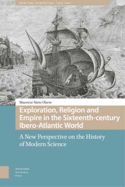
Exploration, Religion and Empire in the Sixteenth-century Ibero-Atlantic World

Exploration, Religion and Empire in the Sixteenth-century Ibero-Atlantic World

A New Perspective on the History of Modern Science

The Iberian conquest of the Atlantic at the beginning of the sixteenth century had a notable impact on the formation of the new world order in which Christian Europe claimed control over most a considerable part of the planet. This was possible thanks to the confluence of different and inseparable factors: the development of new technical capacities and favorable geographical conditions in which to navigate the great oceans; the Christian mandate to extend the faith; the need for new trade routes; and an imperial organization aspiring to global dominance. The author explores new methods for approaching old historiographical problems of the Renaissance — such as the discovery and conquest of America, the birth of modern science, and the problem of Eurocentrism — now in reference to actors and regions scarcely visible in the complex history of modern Europe: the ships, the wind, the navigators, their instruments, their gods, saints, and demons.
  • Cover
  • Table of Contents
  • Acknowledgments
  • Introduction
    • The New World and the problem of Eurocentrism
    • Science and empire
    • Summary of the chapters in this book
  • 1. The Iberian Peninsula and the Atlantic
    • Portugal and Spain
    • Winds, currents, and sailing ships in the Atlantic
    • Gold, silver, slaves, souls, and a thousand kinds of trees
  • 2. The imperial bureaucracy and the appropriation of the New World
    • Seville and the Casa de Contratación
    • The universal monarchy
  • 3. The piloto mayor: cosmography and the art of navigation
    • The post of piloto mayor: seamanship and cartography
    • The navigation manuals
    • Manuals for the Empire
    • Publications, dissemination, and secrecy
    • Humanism and the classics
    • Experience and authority
    • Man against the sea: shipwrecks and meteorology
    • Routes and chorographic descriptions: The New World within the new global order
  • 4. Machines of the empire
    • The ships
    • Shipbuilding
    • War and artillery
    • Navigational instruments
      • The astrolabe
      • The cross-staff
      • The mariner’s compass
      • Time and clocks
      • The sounding/plumb line
      • The navigation charts
      • Astronomical tables
      • Instruments, measurements, precision, and standardization
    • The crew
      • The captain/admiral
      • The pilot
      • The shipmaster (maestre) and quartermaster (contramaestre)
      • The boatswain (guardián)
      • The ordinary seamen (marineros)
      • Midshipmen (grumetes) and cabin boys (pajes)
      • The carpenter, steward, cooper, and cook
      • The scribe, master-at-arms, and overseer
      • The cannoneer
      • The barber/surgeon
      • The priest
    • Life on board
      • The argot of the sailors
      • Overcrowding
      • Food and health
      • Men of the sea and men of God
  • 5. The Master Map (Padrón Real) and the cartography of the New World
    • Nautical charts and how they were made
    • The making of a chart
    • The charts of tierra firme: the earliest maps of the New World
    • Three early maps of the New World
      • Juan de la Cosa (1500)
      • Waldseemüller (1507)
      • Diego Ribero (1520)
  • 6. The creatures of God never seen before: natural history
    • Nature in the New World
    • The classics and the Bible
    • Monsters in paradise
    • To describe, classify, and name
    • Medicine, botany, and the knowledge of the natives
    • The Empire and natural history
  • 7. The New World, global science, and Eurocentrism
    • Plus ultra
    • Experience and authority
    • The Empire and the challenge of standardization
    • Eurocentrism
  • Bibliography
    • Primary sources
      • Manuals of seamanship
      • Books on natural history
    • Secondary sources
  • About the Author
  • Index
  • List of illustrations
    • Illustration 1.1. ‘On the winds, their quality, and names, and how one should sail in them’. In: Arte de Navegar, by Pedro de Medina. Book III, Folio XVII, 1545 © Obras clásicas de náutica y navegación / José Ignacio González-Aller Hierro (comp.) Madrid:
    • Illustration 1.2. The planetary winds. Rafael David Nieto Bello (based on the maps of Javier Eduardo Pena, Cartography studio). Universidad de los Andes.
    • Illustration 1.3. The main Ocean currents on the Earth. Rafael David Nieto Bello (based on the maps of Javier Eduardo Pena, Cartography studio). Universidad de los Andes.
    • Illustration 1.4. The voyages of Columbus, 1492–1503. Rafael David Nieto Bello (based on the maps of Javier Eduardo Pena, Cartography studio). Universidad de los Andes.
    • Illustration 2.1. Panoramic view of Seville in the 17th century. At the bottom, the inscription reads: ‘Who has not seen Seville has not seen a wonder’. © All rights reserved. Naval Museum, Madrid.
    • Illustration 3.1. Suma de Geographia, by Martín Fernández de Enciso, 1530 © Obras clásicas de náutica y navegación / José Ignacio González-Aller Hierro (comp.) Madrid: Fundación Histórica Tavera, D.L. 1998. Copy taken from the Fundación Mapfre. The drawin
    • Illustration 3.2. Regimiento de Navegación, by Pedro de Medina, 1563. © Obras clásicas de náutica y navegación / José Ignacio González-Aller Hierro (comp.) Madrid: Fundación Histórica Tavera, D.L. 1998. Copy taken from the Fundación Mapfre . The subtitle
    • Illustration 3.3. Cartagena and Punta de los Icacos. In: Luz de navegantes, by Baltasar Vellerino de Villalobos. Book II, Folio LXXXVI. © All rights reserved. Universidad de Salamanca. This map of Cartagena shows the detail given to the depiction of certa
    • Illustration 3.4. Arte de Navegar, by Pedro de Medina. Book I, Folio I, 1545. © Obras clásicas de náutica y navegación / José Ignacio González-Aller Hierro (comp.) Madrid: Fundación Histórica Tavera, D.L. 1998. Copy taken from the Fundación Mapfre. This i
    • Illustration 3.5. The sphere and the four elements. In the Itinerario de Navegación, by Juan Escalante de Mendoza. Book II © All rights reserved Museo Naval, Madrid. Ms. 2519. Digital Copy: Biblioteca Virtual de Andalucía, p.165. The pilot explains to Tri
    • Illustration 3.6. Ptolemaic map. Based on Ptolemy’s Geography, 1507. No original maps of Claudius Ptolemy are conserved. However, in the 15th century, his cartographic techniques were used in maps of the Earth such as this one. In addition to the geograph
    • Illustration 3.7. The four elements: earth, water, air, and fire. In: Itinerario de Navegación, by Juan Escalante de Mendoza, page 91. © All rights reserved. Naval Museum Archive, Madrid.
    • Illustration 3.8. The celestial sphere, with the Earth in the center, around which the Sun, planets, and stars revolve. In: Itinerario de Navegación, by Juan Escalante de Mendoza, page 93. © All rights reserved. Naval Museum Archive, Madrid.
    • Illustration 3.9. Poles of the world and the basic coordinates of the heavenly sphere. In: Itinerario de Navegación, by Juan Escalante de Mendoza, page 94. © All rights reserved. Naval Museum Archive, Madrid.
    • Illustration 3.10. Height of the Sun above the equinoctial line. In: Itinerario de Navegación, by Juan Escalante de Mendoza, page 95. © All rights reserved. Naval Museum Archive, Madrid.
    • Illustration 3.11. The seven planets. In: Itinerario de Navegación, by Juan Escalante de Mendoza, page 97. © All rights reserved. Naval Museum Archive, Madrid.
    • Illustration 3.12. Rules of the tides. In: Instrucción Náutica, by Diego García de Palacio. Book II, chapter VII, p. 59, 1587. © Obras clásicas de náutica y navegación / José Ignacio González-Aller Hierro (comp.) Madrid: Fundación Histórica Tavera, D.L. 1
    • Illustration 3.13. Navigational instructions XIIII: ‘On when the ship is grasped by the force of the weather and is in danger of being lost: what one should do to correct it’. In: Regimiento de Navegación, by Pedro de Medina. Second part, Folio LXX, 1563
    • Illustration 3.14. Navigational instructions XI: ‘On the measures [remedy] which should be taken when the vessel is sailing and ships a lot of water’. In: Regimiento de Navegación, by Pedro de Medina, 1563 © Obras clásicas de náutica y navegación / José I
    • Illustration 4.1. Columbus the first discoverer. Theodor de Bry, 1594. This picture of Columbus, which widely circulated in Europe in the 16th century, shows the struggle of man, with his skills, against the forces of nature, under the protection of God.
    • Illustration 4.2. Navigational instructions II: ‘How the pilot should know the ship in which he has to sail and be familiar with the peculiarities it has’. Second part, Folio LVII. Regimiento de Navegación, by Pedro de Medina, 1563 © Obras clásicas de náu
    • Illustration 4.3. Displays of a ship that sails against the wind and into the wind. In: Itinerario de Navegación, by Juan Escalante de Mendoza. Book 1, page 57, 1575 © Obras clásicas de náutica y navegación / José Ignacio González-Aller Hierro (comp.) Mad
    • Illustration 4.4. Sailing ship with the Fall of Icarus, by Peter Brueghel.
    • Illustration 4.5. ‘On the calculations and other things which pertain to the measurements of the Hull of any Ship’. In: Instrucción Náutica, by Diego García de Palacio. Book IV, p. 94, 1587 © Obras clásicas de náutica y navegación / José Ignacio González-
    • Illustration 4.6. ‘On the calculations and other things which pertain to the measurements of the Hull of any Ship’. In: Instrucción Náutica, by Diego García de Palacio. Book IV, p. 95, 1587 © Obras clásicas de náutica y navegación / José Ignacio González-
    • Illustration 4.7. On the mainsail and foresail. In: Instrucción Náutica, by Diego García de Palacio. Book IV, chapter X, p. 104, 1587 © Obras clásicas de náutica y navegación / José Ignacio González-Aller Hierro (comp.) Madrid: Fundación Histórica Tavera,
    • Illustration 4.8. Maritime astrolabe. In Quatri Partitu en Cosmographia Practica, by Alonso de Chaves. Book I, Second Treatise, Chapter III, p. 120. © Obras clásicas de náutica y navegación / José Ignacio González-Aller Hierro (comp.) Madrid: Fundación Hi
    • Illustration 4.9. ‘Explanation of the position the sailor must follow when he is sailing on the sea and wishes to know the height [altitude] of the Sun’. In: Itinerario de Navegación, by Juan Escalante de Mendoza. Book III, p. 247, 1575 © Obras clásicas d
    • Illustration 4.10. Nautical astrolabe. Detail of the mappa mundi of Diego Ribero, 1529. © All rights reserved. Naval Museum, Madrid.
    • Illustration 4.11. Explanation of the astrolabe for taking the height of the Sun and its use. In: Instrucción Náutica, by Diego García de Palacio. Book I, chapter III, p. 26, 1587 © Obras clásicas de náutica y navegación / José Ignacio González-Aller Hier
    • Illustration 4.12. Explanation of the quadrant for taking the height of the Sun and the stars, and its use. In: Instrucción Náutica, by Diego García de Palacio. Book I, Chapter III, p. 26, 1587 © Obras clásicas de náutica y navegación / José Ignacio Gonzá
    • Illustration 4.13. Drawing of the use of the astronomical staff or cross-staff. Sellers, John, 1672. Based on the book of Pedro de Medina.
    • Illustration 4.14. On the height of the north. In: Regimiento de Navegación, de Pedro de Medina. Book III, Folio XXXV, 1563 © Obras clásicas de náutica y navegación / José Ignacio González-Aller Hierro (comp.) Madrid: Fundación Histórica Tavera, D.L. 1998
    • Illustration 4.15. Use of the cross-staff. In: Instrucción Náutica, by Diego García de Palacio. Book I, p. 39, 1587 © Obras clásicas de náutica y navegación / José Ignacio González-Aller Hierro (comp.) Madrid: Fundación Histórica Tavera, D.L. 1998. Copy t
    • Illustration 4.16. Order and rule of the Southern Cross in order to take its height, both on sea and on land. In: Instrucción Náutica, de Diego García de Palacio. Book I, Chapter VIII, p. 44, 1587 © Obras clásicas de náutica y navegación / José Ignacio Go
    • Illustration 4.17. Explanation of the mariner’s compass. In: Itinerario de Navegación, de Juan Escalante de Mendoza, p. 112, 1575 © Obras clásicas de náutica y navegación / José Ignacio González-Aller Hierro (comp.) Madrid: Fundación Histórica Tavera, D.L
    • Illustration 4.18. Compass needle. In: Quatri Partitu en Cosmographia Practica, by Alonso de Chaves. Book I, Second Treatise, Chapter I, p. 107. © Obras clásicas de náutica y navegación / José Ignacio González-Aller Hierro (comp.) Madrid: Fundación Histór
    • Illustration 4.19. Compass rose. In: Instrumentos de navegación, by Manuel Sellés, p. 17. The compass rose wound up being divided into thirty-two courses in the Atlas Maior of Blaeu, 1662. © All rights reserved. Naval Museum, Madrid.
    • Illustration 4.20. Carta pisana (Pisan map), c. 1275. This is possibly the oldest Portolan chart that has been conserved and clearly shows the mesh of lines that mark out the routes.
    • Illustration 4.21. On the mariner’s compasses. In: Regimiento de Navegación, by Pedro de Medina. Book IV, Folio XIV, 1563 © Obras clásicas de náutica y navegación / José Ignacio González-Aller Hierro (comp.) Madrid: Fundación Histórica Tavera, D.L. 1998.
    • Illustration 4.22. Sixteenth-century mariner’s sandglass. In: Instrumentos de Navegación, by Manuel Sellés, p. 32. © All rights reserved. Naval Museum, Madrid.
    • Illustration 4.23. Night chart to determine the hours with the North Star. In: Instrucción Náutica, by Diego de García de Palacio. Book I, Chapter VII, p. 42, 1587 © Obras clásicas de náutica y navegación / José Ignacio González-Aller Hierro (comp.) Madri
    • Illustration 4.24. On sailing in the western seas and lands. In: Itinerario de Navegación, by Juan Escalante de Mendoza. Book III, p. 252, 1575 © Obras clásicas de náutica y navegación / José Ignacio González-Aller Hierro (comp.) Madrid: Fundación Históri
    • Illustration 4.25. Table of the Sun’s declination. In, Regimiento de Navegación, by Pedro de Medina. Book III, Folio XXVII, 1563 © Obras clásicas de náutica y navegación / José Ignacio González-Aller Hierro (comp.) Madrid: Fundación Histórica Tavera, D.L.
    • Illustration 4.26. On the height of the Sun and the rules for navigating by it. In: Arte de Navegar, by Pedro de Medina. Book III, Chapter IIII, Folio XXXIX, 1545 © Obras clásicas de náutica y navegación / José Ignacio González-Aller Hierro (comp.) Madrid
    • Illustration 4.27. Perpetual table to find out lunar conjunctions. In: Regimiento de Navegación, by Pedro de Medina. Book V, Chapter I, Folio XIV, 1563 © Obras clásicas de náutica y navegación / José Ignacio González-Aller Hierro (comp.) Madrid: Fundación
    • Illustration 4.28. Phases of the Moon. In: Itinerario de Navegación, by Juan Escalante de Mendoza, p. 228. © All rights reserved. Naval Museum Archive, Madrid.
    • Illustration 4.29. Tables to find out at what hours the tides come. In: Regimiento de Navegación, by Pedro de Medina. Book V, Chapter X, folio LIII, 1563 © Obras clásicas de náutica y navegación / José Ignacio González-Aller Hierro (comp.) Madrid: Fundaci
    • Illustration 4.30. Calendar. In: Arte de Navegar, by Pedro de Medina, Folio LXII, 1545 © Obras clásicas de náutica y navegación / José Ignacio González-Aller Hierro (comp.) Madrid: Fundación Histórica Tavera, D.L. 1998. Copy taken from the Fundación Mapfr
    • Illustration 5.1. Map of the recently discovered New World. In: Décadas del Nuevo Mundo, by Pedro Mártir de Angleria, 1511.
    • Illustration 5.2. Map of the New World. In: Crónica del Perú, by Pedro Cieza de León, 1554. Taken from the book by Francisco Vindel, Mapas de América en los libros españoles entre el siglo XVI al XVIII, 1955, p. 43. © All rights reserved. National Library
    • Illustration 5.3. Maps of different parts of America. In: Historia general de los hechos de los castellanos en las islas y tierra firme del mar océano, by Antonio de Herrera, Madrid (1601–1615). Taken from the book by Francisco Vindel, Mapas de América en
    • Illustration 5.4. Navigational chart containing the navigation of most of Europe, Africa, the Indies or New World, and their respective altitudes and degrees In: Arte de Navegar, by Pedro de Medina. Book III, Folio XXII, 1545 © Obras clásicas de náutica y
    • Illustration 5.5. The leagues calculated by degree in each course of the voyage. In: Regimiento de Navegación, by Pedro de Medina. First book, Chapter VIII, Folio XIII, 1563 © Obras clásicas de náutica y navegación / José Ignacio González-Aller Hierro (co
    • Illustration 5.6. Juan de la Cosa’s Map, 1500. © All rights reserved. Naval Museum, Madrid.
    • Illustration 5.7. Compass rose with a picture of the Virgin Mary and Jesus at the center of the map by Juan de la Cosa, 1500. © All rights reserved. Naval Museum, Madrid.
    • Illustration 5.8. In the middle of the New World the figure of Saint Christopher crosses the seas, suggesting the idea of a passage to the Orient. Detail of the map by Juan de la Cosa, 1500. © All rights reserved. Naval Museum, Madrid.
    • Illustration 5.9. Universalis Cosmographie descriptio in plano. In: Introductio, by Martin Waldseemüller, 1507.
    • Illustration 5.10. Universal map containing all of the world that has been discovered up to now. Diego Ribero, Seville, 1529. The map is divided into two parts in accordance with Treaty of Tordesillas, 1594, in which the Catholic monarchs of Spain and Kin
    • Illustration 5.11. Quadrant. Detail from the Carta Universal of Diego Ribero, 1529. Observational instruments were an important subject on the map. Here, we see a drawing that shows one how to use the quadrant. © All rights reserved. Naval Museum, Madrid.
    • Illustration 5.12. Toponymy of the New World. Detail of the Carta Universal of Diego Ribero, 1529. Along the length and breadth of the map there are finely drawn figures of ships, as well as a host of place names drawn on the New World and Africa. All of
    • Illustration 6.1. Iguana. In: Historia general y natural de las Indias, by Gonzalo Fernández de Oviedo, 1535. Folio 103. © All rights reserved. Royal Academy of History, Madrid.
    • Illustration 6.2. Pineapple. In: Historia general y natural de las Indias, by Gonzalo Fernández de Oviedo, 1535. Folio 77. © All rights reserved. Royal Academy of History, Madrid.
    • Illustration 6.3. Tlazolteozacatl, Tlayapaloni, Axocotl, Chicomacatl. In: Librito de las hierbas medicinales de los indios, by Martín de la Cruz, 1552. The text below the drawings explains: ‘Remedy for a mistreated body. The body which is broken and mistr
    • Illustration 6.4. Tezonpahtli, Huitzquilitl, Tecuammaitl. In: Librito de las hierbas medicinales de los indios, by Martín de la Cruz, 1552. The text below the drawings explains: ‘Scabies: the mangy head is washed in urines. Then, you put a mixture of the
    • Illustration 6.5. Atzitzicaztli. In: Librito de las hierbas medicinales de los indios, by Martín de la Cruz, 1552. The text explains: ‘Herb to stem bleeding. When placed in the nose, the juice of nettles, ground with salt in urine and milk, stems nasal he
    • Illustration 6.6. Museum of Ferrante Imperato in Naples, 1599.
    • Illustration 7.1. Frontispiece of Francis Bacon’s Instauratio Magna, 1620.
    • Illustration 7.2. Historia general y natural de las Indias, Gonzalo Fernández de Oviedo, 1535.
    • Illustration 7.3. Regimiento de Navegación, by Andrés García de Céspedes, Folio I.

SUSCRÍBASE A NUESTRO BOLETÍN

Al suscribirse, acepta nuestra Politica de Privacidad

Title

Text