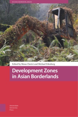
Development Zones in Asian Borderlands maps the nexus between global capital flows, national economic policies, infrastructural connectivity, migration, and aspirations for modernity in the borderlands of South and South-East Asia. In doing so, it demonstrates how these are transforming borderlands from remote, peripheral backyards to front-yards of economic development and state-building. Development zones encapsulate the networks, institutions, politics and processes specific to enclave development, and offer a new analytical framework for thinking about borderlands; namely, as sites of capital accumulation, territorialisation and socio-spatial changes.
- Cover
- Table of Contents
- Acknowledgements
- Introduction
- Enclave Development and Socio-spatial Transformations in Asian Borderlands
- Mona Chettri and Michael Eilenberg
- 1 Post-disaster Development Zones and Dry Ports as Geopolitical Infrastructures in Nepal
- 2 Onwards and Upwards
- Aerial Development Zones in Nepal
- 3 Casinos as Special Zones
- Speculative Development on the Nation’s Edge
- 4 Thinking the Zone
- Development, Climate, and Heterodystopia
- 5 From Shangri-La to De facto SEZ
- Land Grabs from “Below” in Sikkim, India
- 6 Development Zones in Conflict-Affected Borderlands
- The Case of Muse, Northern Shan State, Myanmar
- Patrick Meehan, Sai Aung Hla and Sai Kham Phu
- 7 Smart Enclaves in the Borderland
- Digital Obligations in Northeast India
- 8 Post-Disaster Economies at the Margins
- Development, Profit, and Insecurities Across Nepal’s Northern Borderlands
- 9 Development from the Margins
- Failing Zones and Suspended Development in an Indonesian Border Village
- 10 From Boom to Bust – to Boom Again?
- Infrastructural Suspension and the Making of a Development Zone at the China-Laos Borderlands
- 11 Genealogies of Extraction
- De Facto Development Zones in the Indonesian Borderlands
- Thomas Mikkelsen and Michael Eilenberg
- Notes on Contributors
- Index
- List of Figures and Tables
- Figures
- Figure 0.1 Overview map of chapter authors and locations
- Figure 1.1 Roads and dry ports of Sindhupalchok, Rasuwa, and Mustang Districts
- Figure 1.2 Larcha dry port, April 2019
- Figure 2.1 A Lion Air flight landing at Tribhuvan International Airport, Kathmandu, July 2019
- Figure 2.2 Proposed Himalaya 2 Route
- Figure 4.1 Climate Smart Integrated House, Gabura, Bangladesh
- Figure 4.2 Backyard of the Climate Smart Integrated House, Gabura, Bangladesh
- Figure 5.1 Concrete aspirations: Sun Pharmaceuticals factory and new constructions along the Seti river
- Figure 5.2 Ambiguous claims: dilapidated CWC signboard
- Figure 5.3 ‘Tight spaces’: bordering on the edges of licit and illicit
- Figure 6.1 Map: Muse-Ruili4
- Figure 7.1 Screenshot of the Imphal Smart City Webpage, April 2020
- Figure 8.1 Tsum in a regional context
- Figure 8.2 Habitual cross-border geographies in Tsum
- Figure 8.3 Appey’s tented shop at Bachu
- Figure 8.4 A woman pauses during construction on a walking trail in Tsum
- Figure 9.1 As a way to brace themselves for an urbanised future, sub-district and village offices worked together to expand the village’s settlement area (Long Nawang, 2018)
- Figure 9.2 On the corner of the non-functioning diesel power plant, the facility’s in-situ technician/guard uses one of the transformers to dry his kitchen towels (Long Nawang, 2018)
- Figure 10.1 Abandoned swimming pool near an apartment complex in Boten
- Figure 10.2 Bulldozers working 24/7 to clear ground for a new housing project in the Boten SEZ (2017)
- Figure 11.1 Locations of proposed KEKs I and II
- Figure 11.2 What is today a grazing field for livestock was once the site of some of the most productive oil wells in Indonesia, attracting capital and labour from all over the world
- Figure 11.3 Thousands of tambaks – freshwater ponds for farming tiger shrimp – steadily proliferate up the rivers and waterways of North Kalimantan
- Tables
- Table 6.1 Militias operating in Muse
- Table 7.1 Table of number of projects in bid

