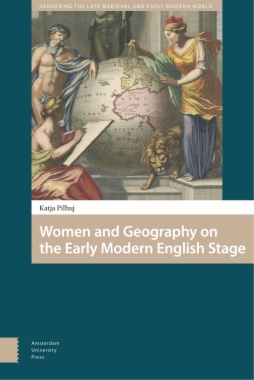
Women and Geography on the Early Modern English Stage

Women and Geography on the Early Modern English Stage

In a late 1590s atlas proof from cartographer John Speed, Queen Elizabeth appears, crowned and brandishing a ruler as the map's scale-of-miles. Not just a map key, the queen's depiction here presents her as a powerful arbiter of measurement in her kingdom. For Speed, the queen was a formidable female presence, authoritative, ready to measure any place or person. The atlas, finished during James' reign, later omitted her picture. But this disappearance did not mean Elizabeth vanished entirely; her image and her connection to geography appear in multiple plays and maps. Elizabeth becomes, like the ruler she holds, an instrument applied and adapted. Women and Geography on the Early Modern English Stage explores the ways in which mapmakers, playwrights, and audiences in early modern England could, following their queen's example, use the ideas of geography, or 'world-writing', to reshape the symbolic import of the female body and territory to create new identities. The book demonstrates how early modern mapmakers and dramatists -- men and women -- conceived of and constructed identities within a discourse of fluid ideas about space and gender.
  • Cover
  • Table of Contents
  • Acknowledgments
  • Introduction
  • 1. Confuting Those Blind Geographers
    • Christopher Marlowe’s Spectacle of Maps and the Female Body
  • 2. ‘T’illumine the now obscurèd Palestine’
    • Elizabeth Cary and the Mapping of Early Modern Marriage and Colonialism
  • 3. ‘Willing to Pay Their Maidenheads’
    • Thomas Heywood and the Cartography of Bodily Commerce
  • 4. ‘The Fort of her Chastity’
    • Cavendish’s Mapmakers of Virtue
  • Conclusion
    • Women as World-Writers
  • Bibliography
  • Index
  • List of Figures
    • Fig. 1: John Speed, Detail, Proof Map of Cheshire, Theatre of the Empire of Great Britain. Reproduced by kind permission of the Syndics of Cambridge University Library (Atlas.2.61.1, p. 16).
    • Fig. 2: Frontispiece, Christopher Saxton, An Atlas of England and Wales. London: 1579. © The Trustees of the British Museum (1934, 0604.1).
    • Fig. 3: Portrait of Henri after the titlepage, Maurice Bouguereau, Le Theatre Francoys (Tours, 1594). Bibliothèque Nationale de France, département Réserve des livres rares, RES-L7-2 (gallica.bnf.fr).
    • Fig. 4: Giacomo Gastaldi, Cosmographia Universalis c. 1561© The British Library Board (Cartographic Items Maps C.18.n.1.)
    • Fig. 5: Queen Elizabeth I (‘The Ditchley Portrait’) by Marcus Gheeraerts the Younger, c. 1592. © National Portrait Gallery, London.
    • Fig. 6: WA.Suth.C.2.91.3 Anonymous Dutch, Queen Elizabeth I as a map of Europe, 1598 Image © Ashmolean Museum, University of Oxford.
    • Fig. 7: Frontispiece, John Case, Sphaera Civitatis [The Sphere of State] (Oxford, 1588). Newberry Library, Chicago (Special Collections Case J 0. 148).
    • Fig. 8: Title page, Abraham Ortelius’ Theatrum Orbis Terrarum (Antwerp, 1570). Courtesy of the Library of Congress, Geography and Map Division (G1006. T5 1570b Vault fol).
    • Fig. 9: Petrus Plancius, ‘Orbis terrarum typus de integro multis in locis emendatus’ (Amsterdam, 1599). National Library of Australia (NLA MAP RM 144).
    • Fig. 10: Jan van der Straet, called Stradanus, ‘Discovery of America: Vespucci Landing in America’ (c. 1587-89) The Metropolitan Museum of Art, New York. Gift of Estate of James Hazen Hyde, 1959.
    • Fig. 11: Anonymous (after Jodocus Hondius), ‘Florentissimoru Regnorum Angliae et Hiberniae accurata descriptio’ (1594). Royal Geographic Society (with IBG). Shelfmark: mr British Isles Div.55.
    • Fig. 12: Title page, Dudley Digges, The Compleat Ambassador: or Two Treaties of the Intended Marriage of Qu. Elizabeth of Glorious Memory (London, 1655). © The Trustees of the British Museum (1976, U.25).
    • Fig. 13: Michael Drayton, title page, Poly-olbion (1612). © The British Library Board (General Reference Collection DRT Digital Store 641.k.11).
    • Fig. 14: John Speed, ‘The Kingdom of Irland’, Theatre of the Empire of Great Britain (London: J. Sudbury & G. Humble, 1611-1612). © The British Library Board (Cartographic Items G.7884).
    • Fig. 15: Hans Woutneel, ‘A Descripsion of the kingdoms of England Scotland & Ireland’ [London], 1603. Göttingen State and University Library, MAPP 4570.
    • Fig. 16: John Speed, Map of Scotland, Theatre of the Empire of Great Britain (London: I. Sudbury and G. Humble, 1616) ©The British Library Board (Maps. C.7 .c20.(2)).
    • Fig. 17: London map from Georg Braun and Frans Hogenberg, Civitates orbis terrarum (Cologne, 1572). © The British Library Board (Maps.C29.e.1).
    • Fig. 18: The Armada Portrait of Elizabeth I by George Gower, c. 1588. From the Woburn Abbey Collection.
    • Fig. 19: Johannes Vermeer, Officer and Laughing Girl, c. 1657. Copyright The Frick Collection, New York.
    • Fig. 20: Margaret Cavendish, Frontispiece to Playes (1662) and Playes, Never Before Printed (1668). © The Trustees of the British Museum (1862, 1011.236).
    • Fig. 21: Aaron Rathborne, The Surveyor in Foure Books (Printed by W. Stansby for W. Burre, 1616). © The Trustees of the British Museum (1875, 0814.741).
    • Fig. 22: Frontispiece from Britannia fortior (London, 1709). © University of Aberdeen.

SUBSCRIBE TO OUR NEWSLETTER

By subscribing, you accept our Privacy Policy