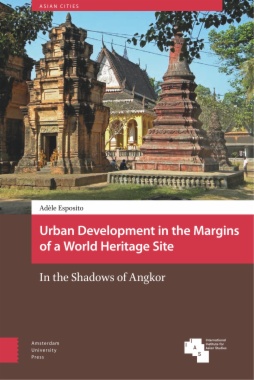
Urban Development in the Margins of a World Heritage Site

Urban Development in the Margins of a World Heritage Site

In the Shadows of Angkor

  • Author: Esposito, Adèle; Esposito, Adèle
  • Publisher: Amsterdam University Press
  • Serie: Asian Cities
  • ISBN: 9789462983687
  • eISBN Pdf: 9789048534050
  • Place of publication:  Amsterdam , Netherlands
  • Year of digital publication: 2018
  • Month: April
  • Pages: 368
  • Language: English
This volume addresses the relationship between the UNESCO World Heritage Site of Angkor (Cambodia), and the nearby town of Siem Reap. While previous work on heritage sites has mainly focused on protected areas, this book shifts the attention to the margins, where detrimental, tourism-driven urban development may take place. By delimiting a protected site, a non-heritage space is created in which spatial fragmentation, disruptive development processes, and unjust power plays can occur. In post-war Cambodia, liberalization and collective aspirations for progress have provided a strong incentive for modernization. Controversial interests compete in the arena of urban development, and real estate development prevails over planned growth. At the same time, Siem Reap’s marginal position allows for some freedom in architectural and urban design. In the shadow of institutional control, this architectural space expresses alternative visions of the Khmer heritage and connects them with images of urban modernity.
  • Cover
  • Contents
    • Abbreviations
    • Glossary of Khmer terms
    • Acknowledgements
    • Author’s Preface
    • Introduction
      • Ordinary diversity? A secondary tourist city in Southeast Asia
      • Building the city after conflict
      • Understanding the politics of heritage from the margins
      • Designing a research trajectory
      • The content and structure of the book
    • 1 ‘Before you build a wall, think of what you are leaving outside it’ 
      • The construction of core and marginal spaces in the Angkor region
      • 1.1 The triad of heritage conservation
      • 1.2 Angkor, an international icon
      • 1.3 Shaping the legal and institutional heritage system for Angkor
      • 1.4 Zoning a region shaped by Angkor’s legacy
      • 1.5 Expanding the heritage system: From the monument to the landscape
      • 1.6 Contracting the heritage system: From the landscape to the archaeological park
      • 1.7 Fragile and malleable Siem Reap
    • 2 The arena of urban planning and the idea of the city
      • 2.1 Everyone wants a slice of the pie
      • 2.2 Planners as cultural brokers
      • 2.3 Spatial layouts and ideas of the city
      • 2.4 The buttresses of planning
      • 2.5 Projects
      • 2.6 The power of action and the power of ideas
    • 3 The city as developers’ playground
      • 3.1 Our potential field is tourism
      • 3.2 Reconnecting the disenfranchised links of the economic chain
      • 3.3 An irrational property market
      • 3.4 Negotiating the land laws
      • 3.5 Invisible investment
      • 3.6 A dismal attempt at beautification
      • 3.7 Material effects: Processes and impacts of urban development
      • 3.8 Urban transformation by the local people
      • 3.9 The trajectory of Siem Reap’s urban transition
    • 4 The architectural space
      • How contemporary design shapes urban identities and ideas of modernity
      • 4.1 Angkor: From discovery to commodity
      • 4.2 Emotional authenticity
      • 4.3 Taming exoticism
      • 4.4 Representing and planning the tourist space
      • 4.5 All hotels want to be ‘Grand’
      • 4.6 The quest for the local
      • 4.7 Spectacular heritage: The museums of Siem Reap
      • 4.8 Thematizing urban heritage for consumption
      • 4.9 Models and imitative trends: Towards a contemporary Cambodian architecture?
    • Conclusion
      • Heritage space and non-heritage space: A heuristic model
      • The trajectories of the ‘coloniality of power’
      • The town, forgotten and yet central
    • Bibliography
    • Index
  • List of figures
    • A Map of Southeast Asia and Cambodia
    • Figure B UNESCO signpost indicating the boundaries of the Angkor archaeological park
    • Figure C Total contribution made by tourism and travel to Cambodia’s GDP, accessed 21 July 2016
    • Figure D Siem Reap urban area in 2005
    • Figure 1.1 The archaeological parks of Angkor, as defined by the EFEO in 1925 and the Khmer Republic in 1970
    • Figure 1.2 The archaeological parks of Angkor, as defined by the World Heritage listing
    • Figure 1.3 Archaeological map of the Angkor region
    • Figure 1.4 IGN map 1962 reworked by ARTE (1995)
    • Figure 1.5 The Neak Ta Ya Tep, the spirit protector
    • Table 2.1 Net official development assistance and official aid received by Cambodia between 1991 and 2015
    • Figure 2.2 Urban zoning as proposed by the Urban Reference Plan
    • Figure 2.3 Replica of a noria and wooden bridge in the Old Market area
    • Figure 2.4 Functional zoning as proposed by Groupe 8 in 1999
    • Figure 2.5 Functional zoning as proposed by JICA in 2006
    • Figure 2.6 Sample of inventoried building
    • Figure 2.7 Project for the Hotel City
    • Figure 2.8 The main axis, which passes through the land reserve of the tourism district and gives access to the archaeological park
    • Figure 2.9 The Grand Panorama Museum
    • Figure 2.10 Movable houses on the Tonlé Sap
    • Figure 2.11 The changing Chong Kneas landscape
    • Table 3.1 Incoming FDI to Cambodia by country of origin and sector
    • Table 3.2 Statistics of tourism investment compiled by the CDC, 1995-2009
    • Figure 3.3 Houses along the eastern bank of Siem Reap River
    • Figure 3.4 Maps of the applications for building permits for all types of project and for tourist accommodation and facilities issued between 2000 and 2009
    • Figure 3.5 10 January 1979 High School before transformation
    • Figure 3.6 Shophouses along Sivatha Road
    • Figure 3.7 The evolution of land use in the administrative district, 2009 and 2015
    • Figure 3.8 Somadevi Hotel, Sivatha Road
    • Figure 3.9 Shophouses surrounding the Phsar Leu Market
    • Figure 3.10 Urban landscape along National Highway No. 6
    • Figure 3.11 The hotel with the highest pinnacle in town
    • Figure 3.12 Road to nowhere: the main avenue of Borey Seang Nam
    • Figure 3.13 Shophouses at Borey Sokleap
    • Figure 3.14 Urban sequences along National Highway No. 6
    • Figure 3.15 The Charming Tourist City
    • Figure 3.16 Wat Bo: localization map, sketch and picture of the surveyed area
    • Figure 3.17 Taphul: localization map, sketch and picture of the surveyed area
    • Figure 3.18 Siem Reap province, district, and municipality
    • Figure 4.1 Ancient road discovered in the midst of the ruins of Pontéay Preah Khan
    • Figure 4.2 Replica of Angkor Wat temple at the 1931 colonial exhibition
    • Figure 4.3 Raffles Grand Hotel
    • Figure 4.4 A hotel that wants to be ‘grand’ : façade; bottom
    • Figure 4.5 A hotel that wants to be ‘grand’: internal courtyard
    • Figure 4.6 Internal courtyard of the Park Hyatt Hotel, ex-Hotel de la Paix
    • Figure 4.7 Reproduction of Angkor sculpture at the Angkor Howard Hotel
    • Figure 4.8 Reproduction of colonial architecture and atmosphere at the Victoria Hotel
    • Figure 4.9 The Heritage Hotel
    • Figure 4.10 Monks’ houses, Wat Bo
    • Figure 4.11 Angkor Village hotel
    • Figure 4.12 Mahogany Guesthouse
    • Figure 4.13 Mom’s Guesthouse façade
    • Figure 4.14 Reproduction of a village of the Kola, an ethnic minority originally from Burma, in the Cambodian Cultural Village
    • Figure 4.15 The Angkor National Museum
    • Figure 4.16 Grand Café: plan of the first floor, façade, and cross-section
    • Figure 4.17 The Hard Rock Café
    • Figure 4.18 Sala Lodge Hotel
    • Figure 4.19 Extension of the Somadevi Hotel by ASMA Architecture

SUBSCRIBE TO OUR NEWSLETTER

By subscribing, you accept our Privacy Policy