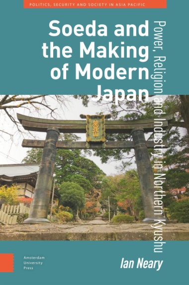
Soeda’s story provides insights into the last thousand years of Japanese history. It was the location of a strategically important castle, Ganjakujo, from the twelfth century until its destruction by Toyotomi Hideyoshi in 1587. Ganjakujo controlled access to Mt Hiko which was the most important Shugend. monastic community in Kyushu until its dissolution in the 1870s. Coal mines in Soeda in the first half of the twentieth century owned by the Kurauchi family drove the modernization of the town and contributed to the industrialization of the country. During the Pacific war, these mines employed Korean labourers and Allied POWs. The town continued to contribute to national economic growth in the 1950s but, following the switch to oil as the main source of energy, its coal mines closed in the 1960s. For forty years between 1971–2010, Mayor Yamamoto Fumio sheltered the town from the worst impact of being ‘left behind’, yet the town continues to seek a new identity in the twenty-first century.
- Cover
- Table of Contents
- Preface and acknowledgements
- 1. Introduction and early history
- 2. Mt Hiko: the evolution of a monastic community
- 3. Soeda: its early modern history
- 4. The modernization of Soeda
- 5. Coal mining in Soeda
- 6. Soeda in the war years
- 7. Soeda under occupation and after
- 8. Buraku in Soeda
- 9. ‘Post-industrial’ Soeda 1970–2010
- Epilogue: Soeda’s present and future
- List of Mt Hiko’s abbots (zasu)
- Kanji Glossary
- Bibliography
- Index
- List of illustrations and tables
- Figure 1.1 Maps showing location of Soeda in northern Kyushu. Source: reproduced with the permission of Soeda Town Office.
- Figure 1.2 Map of Soeda. Source: reproduced with the permission of Soeda town office.
- Figure 1.3 The province of Buzen. Source: illustration by Suzuko Anai, reproduced with permission of the artist.
- Figure 2.1 Map of the mineiri routes. Source: illustration by Suzuko Anai, reproduced with permission.
- Figure 2.2 Population change on Mt Hiko 1681–1987. Source: adapted from Nagano 1987, p 487; Soeda-chōshi, 1992, p. 413, 525.
- Figure 2.3 Schematic map of the Mt Hiko kekkai (religious boundaries). Source: adapted from Grapard, 2016, pp. 133–5.
- Figure 3.1 Ganjaku castle at the time of the attack by Hideyoshi’s army. Source: illustration by Suzuko Anai, reproduced with permission.
- Figure 4.1 The formation of Soeda township 1885–1955. Source: Soeda-chōshi, 1992, p 706.
- Figure 6.1 The View looking North-East Showing the Social Hall, Steam Plant and the surrounding district.
- Figure 6.2 The Mine Head – possibly the entrance to the Banzai pit.
- Figure 6.3 Bath Room.
- Figures 6.1–6.3 Three sketches of the Ōmine POW camp, summer 1945. Source: Tyson, 1946, used with the permission of the Center for Research: allied POWs under the Japanese.
- Figure 6.4 Aftermath of the Futamata tunnel explosion. Source: this photograph of the Futamata Tunnel was taken 13 November 1945 and appeared in the Nishi Nippon Shinbun on 15 November.
- Figure 9.1 Tanjū –miners’ prewar housing. View down the passage between rows of tanjū the cheap miners’ housing, 1920–1950s.
- Figure 9.2 Statue of a Yamabushi in front of Soeda station. Erected March 1988. Source: photo by the author.
- Figure 9.3 View from the roof of Soeda Town Hall showing the Oak Hall and Soeda Dome. Source: photo by Konomi Akiko, used with permission.
From left to right we can see the Oak Hall with the concert hall to the rear, in the centre the ‘Soeda Dome’ sports
- Table 2.1 Support for the Mt Hiko monastery.
- Table 2.2 Mt Hiko monastic structure.
- Table 2.3 �Population of Mt Hiko 1816–1985.
- Table 4.1 The mayors of Soeda township 1910–2010.
- Table 4.2 Soeda’s population 1911–50.
- Table 4.3 Schools in Soeda in 1873.
- Table 5.1 Development of mining in Soeda and Tagawa, 1899–1909.
- Table 5.2 Accidents in Kurauchi owned mines in Soeda 1914–23.
- Table 5.3 Kurauchi Kōgyō KK coal output: Soeda/Ōto/Kawasaki 1919–38.
- Table 6.1 ‘Forced migration’ of Koreans 1939–45.
- Table 6.2 Employment in the Ōmine mines 1943–4.
- Table 6.3 Arrivals at the Ōmine camp.
- Table 6.4 Nationality of Ōmine POWs as of August 1945.
- Table 6.5 Work performed by POWs by industry May 1944–August 1945.
- Table 6.6 Coal mining employment 1945.
- Table 7.1 Furukawa collieries in Soeda: Output in the occupation period.
- Table 7.2 Furukawa coal output in Soeda 1951–60.
- Table 7.3 Furukawa coal output in Soeda 1961–8.
- Table 8.1 Soeda buraku 1935.
- Table 9.1 Soeda’s population 1955–2020.
- Table 9.2 Social security dependency in Soeda and surrounding area, 1955–2021.

