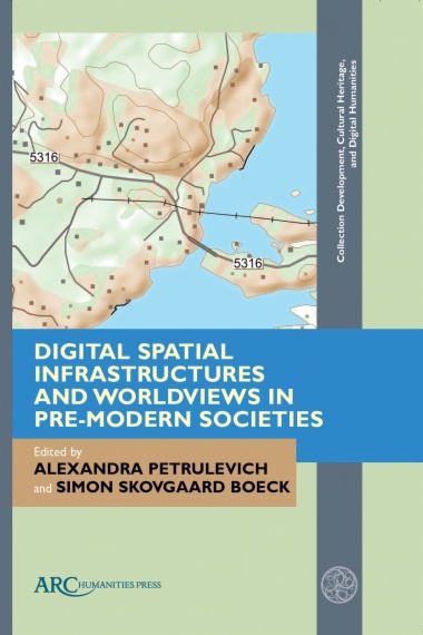
Digital Spatial Infrastructures and Worldviews in Pre-Modern Societies

Digital Spatial Infrastructures and Worldviews in Pre-Modern Societies

The study of medieval and early modern geographic space, literary cartography, and spatial thinking at a time of rapid digitization in the Humanities offers new ways to investigate spatial knowledge and world perceptions in pre-modern societies. Digitization of cultural heritage collections, open source databases, and interactive resources utilizing a rich variety of source materials—place names, early modern cadastral maps, medieval literature and art, Viking Age and medieval runic inscriptions—provides opportunities to re-think traditional lines of research on spatiality and worldviews, encourage innovation in methodology, and engage critically with digital outcomes. In this book, Nordic scholars of philology, onomastics, history, geography, literary studies, and digital humanities examine multiple aspects of ten large- and small-scale digital spatial infrastructures from the early stages of development to the practical applications of digital tools for studying spatial thinking and knowledge in pre-modern sources and societies.
  • Front Cover
  • Half-title
  • Series information
  • Title page
  • Copyright information
  • Table of contents
  • List of Illustrations
  • Introduction
  • Part One. Digital Spatial Infrastructures in the Humanities
    • Chapter 1. Norse World from Plan to Action
      • The Project and the Planning Stage
      • Reality Check: Discovering Data Not Accounted for Previously
      • Building Norse World
      • Norse World Visualization Techniques
      • Final Remarks
      • Bibliography
    • Chapter 2. Mapping Saints
      • Project Description
      • Digital Methods
      • Spatialization and Lived Religion
      • Visualization of Miracles and Pilgrimage
      • Some Additional Challenges with Mapping Lived Religion
      • Conclusions
      • Bibliography
    • Chapter 3. Medieval to Modern
      • Icelandic Saga Map
      • Nafnið.is
      • Case Study: Grettir Ásmundarson and His Place in the Icelandic Landscape
      • Other Grettis- toponyms in the place-name archive
      • Mapping meaning
      • Bibliography
    • Chapter 4. TORA: Topographical Register at the Swedish National Archives
      • Historical GIS as a Tool and Method
      • Seventeenth-Century Maps of Rural Settlements
      • Settlements as Basic Units in TORA
      • Method for Setting Spatial Coordinates
      • TORA and Related Datasets
      • A Linked Data Approach
      • Final Remarks and Conclusions
      • Bibliography
    • Chapter 5. Toward Digital Spatiality
      • The Development of the Place-Name Collection
      • The First Attempt to Make the Collections Available Online
      • Second Attempt to Make the Collections (More) Available
      • The How and Why of the New Digital Register
      • MariaDB Database
      • Elasticsearch Database
      • The Public Application
      • Internal Web Application for Data Maintenance
      • REST Web Service
      • System and Data Management
      • Moving forward
      • Bibliography
  • Part Two. Building and Sustaining Digital Spatial Infrastructures: Challenges and Solutions
    • Chapter 6. Place-Name Databases
      • Place-Name Aspects and Data Integration
      • Location
      • Reference
      • Time
      • Location, Reference and Time: Can They Be Handled Together?
      • The Solution
      • Conclusion
      • Bibliography
    • Chapter 7. Sustainability and Best Practices for Linked Data Heritage Resources
      • The Case for Linked Open Data
      • Sustainability
      • Different Options
      • Personnel Requirements
      • Infrastructural Planning
      • Project Management Resources
      • Maintenance and Planning for End of Life
      • Formats
      • Licensing
      • Technical Long-Term Availability/IRIs
      • Case Studies
      • Conclusion
      • Glossary
      • Bibliography
    • Chapter 8. Integrating Time and Space in a Digital-Historical Administrative Atlas
      • The Administrative Divisions of Denmark
      • Data Structure
      • Dating of Units
      • Integration of Time into GIS Maps of Danish Land Units
      • Viewing and Publishing the Data
      • Conclusion
      • Bibliography
    • Chapter 9. A Digital Periegesis
      • Pausanias and the Study of Space
      • Digital Spatial Research Infrastructures for Classical Studies: The Importance of Linked Open Data and Existing Ecosystems
      • Structuring Data: Existing Gazetteer Ecosystems and Further Data Complexity
      • Conclusions: The Future of the Past
      • Bibliography
  • Part Three. The Norse Perception of the World: Medieval Spatiality in the Digital Age
    • Chapter 10. Flores Travels to Babylon
      • The Middle English, Old West Norse, and Old Swedish Texts
      • The Norse World Resource
      • The External and Internal Journey
      • Leaving the City
      • On a Ship to Babylon
      • Arriving in “Paradise”
      • Lenfer Becomes Fær
      • Conclusion
      • Bibliography
    • Chapter 11. Place-Name Variation in Medieval Literature in the Digital Age
      • Places, Place-Names, and Texts in the Digital Age
      • Place-Names and Place-Name Variation in Humanities Digital Spatial Infrastructures for Research
      • The Norse World Approach to Place-Name Variation
      • Place-Name Variation and Textual Criticism
      • Place-Name Variation and Genre
      • Place-Name Variation and Language Change
      • Final Remarks
      • Bibliography
    • Chapter 12. Nameless Places
      • Denotation without Naming
      • Abstraction
      • Translation Aspects
      • Concluding Remarks
      • Bibliography
    • Concluding Remarks
      • Bibliography
  • Index

Subjects

SUBSCRIBE TO OUR NEWSLETTER

By subscribing, you accept our Privacy Policy

Title

Text